|
|
|
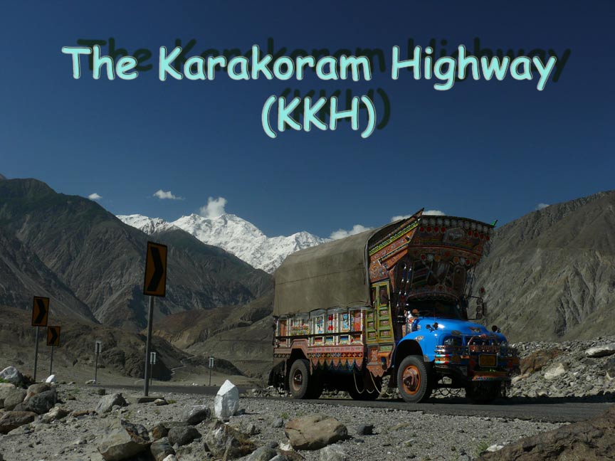
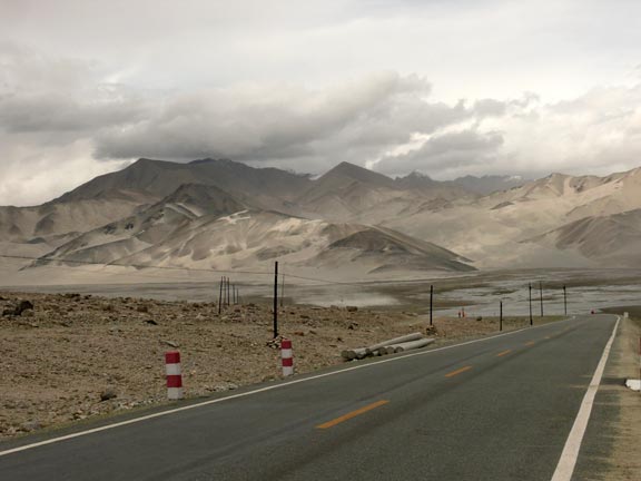
The Karakoram Highway (KKH) is the highest paved
international road in the world. It connects China and Pakistan across the Karakoram mountain range, through the Khunjerab Pass,
at an altitude 15,397 ft. The picture above is
of a typical Pakistani truck with the Nanga Parbat Mountain in the
background. The KKH was built by China and Pakistan and completed in 1978
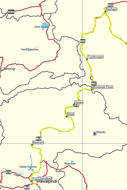
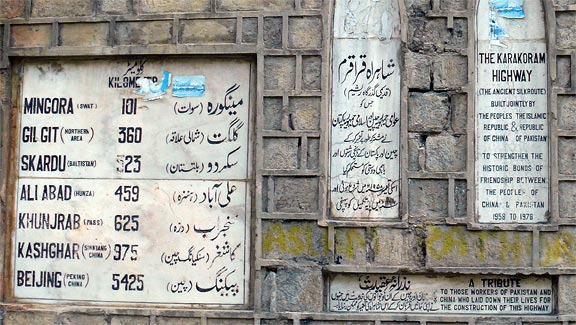
after 20 years of construction. Below left is our GPS track in yellow. The
picture on the right is a marker near Besham. The KKH starts in Pakistan (between
Islamabad and Besham) and ends in Kashgar, China (900 mi to the north). |
|
|
|
|
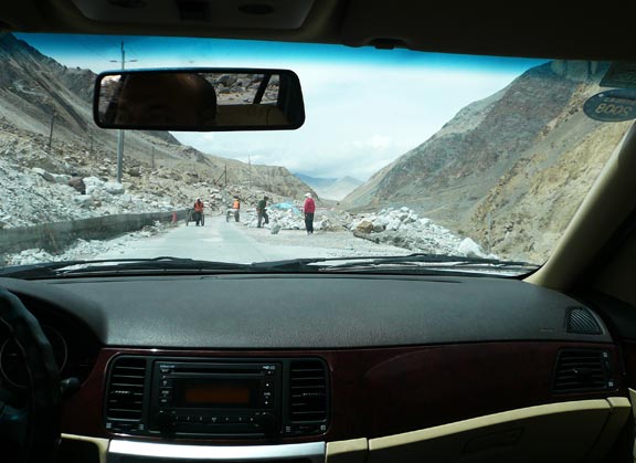
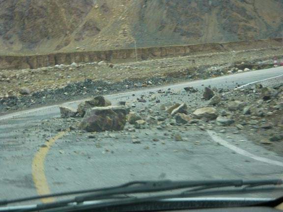
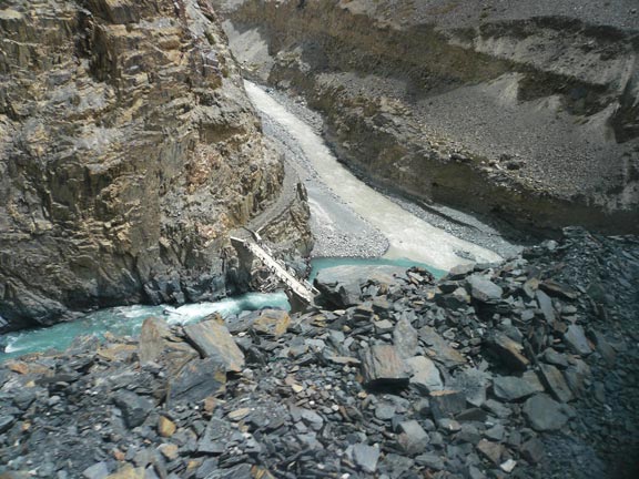
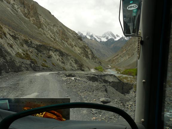
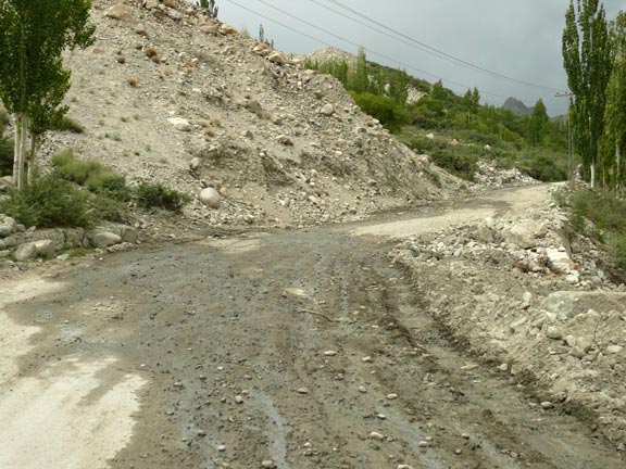
Almost 900 people died
during the construction of the KKH. Even today it is subject to land slides,
rock slides and avalanches. It was closed just days before we took it because
of a big landslide. We encountered the obstacles below which is a common
occurrence. |
|
|
|
|
|
|
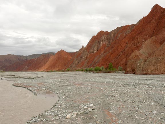
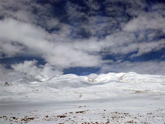
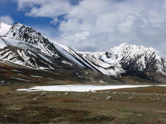
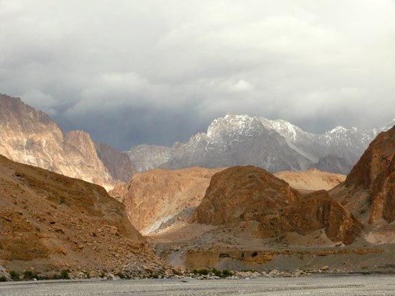
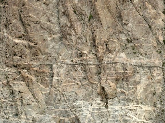
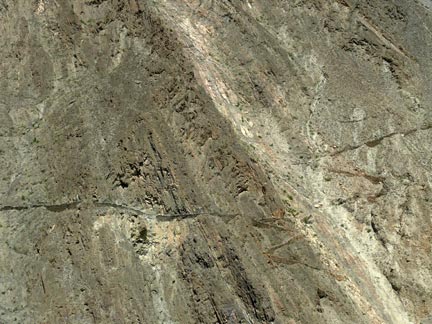
The rock formations, colors, shapes and
scenery along the KKH are stunning and constantly changing. |
|
|
|
|
|
|
|
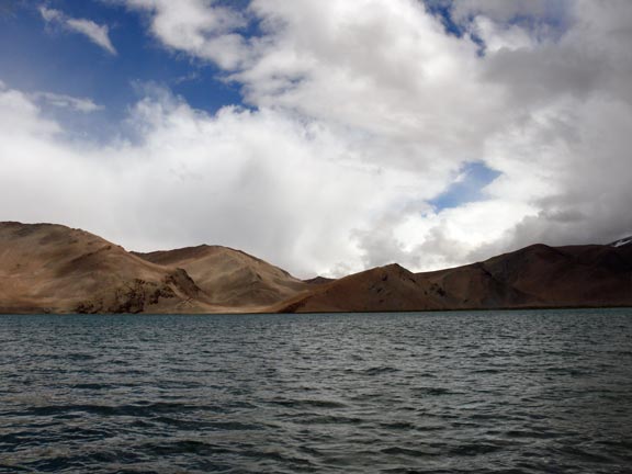
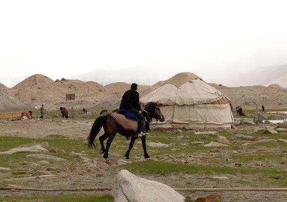
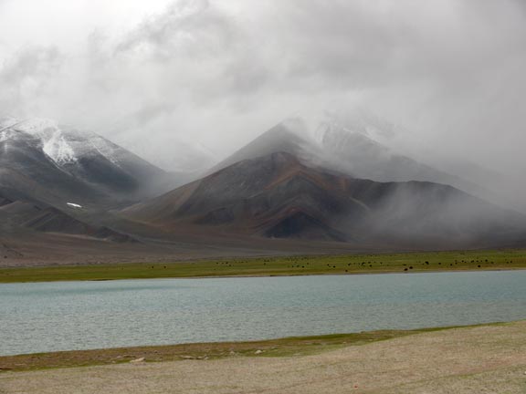
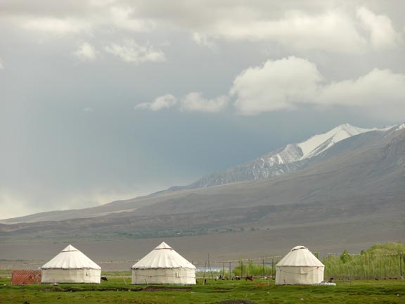
On the way from Kashgar
to Tashkurgan, we stopped at the Karakul Lake (11,800 ft). There are accommodations in gers (below) as this is a
tourist destination from Kahsgar. The place is run by the Tajik people. |
|
|
|
|
|
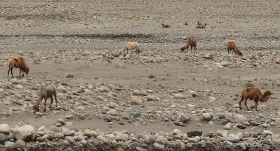
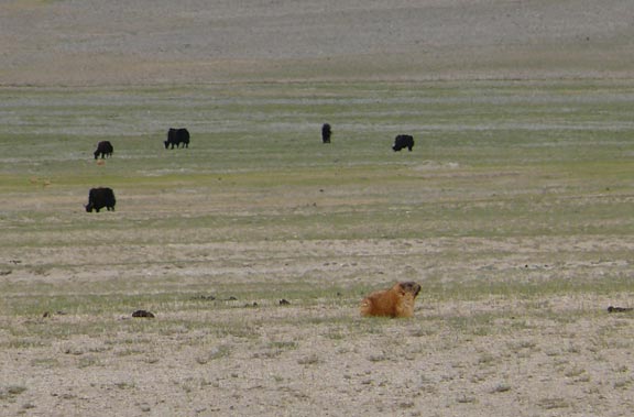
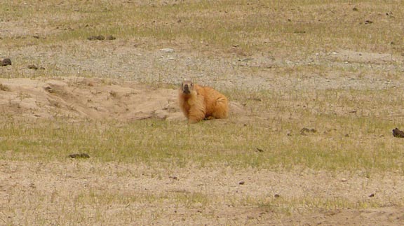
Below
are pictures of grazing yak and pretty big marmots. |
|
|
|
|
|
|
|
|
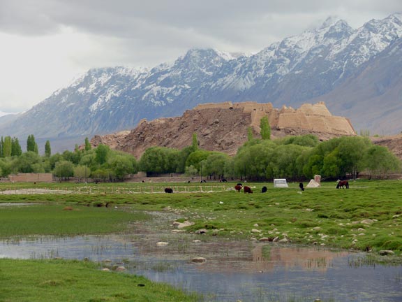
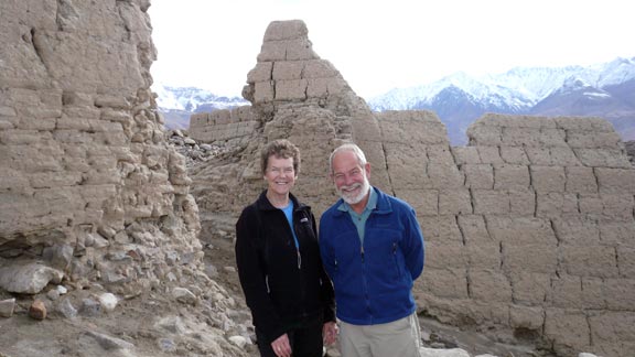
We stayed overnight in
Tashkurgan where the population is mostly Tajik. Above are remains of a castle
dating from the Yuan Dynasty (1277-1367 CE). Tashkurgan is also the
Chinese border check point for continuing into Pakistan (even though it quite
a distance to the actual border). Our original travel plans arranged by our
travel company (Silk Road and Beyond) were for our Chinese guide and driver
to take us all the way to Sost, the border check point in Pakistan. Because
of security concerns for the upcoming Beijing Olympics, the Chinese closed
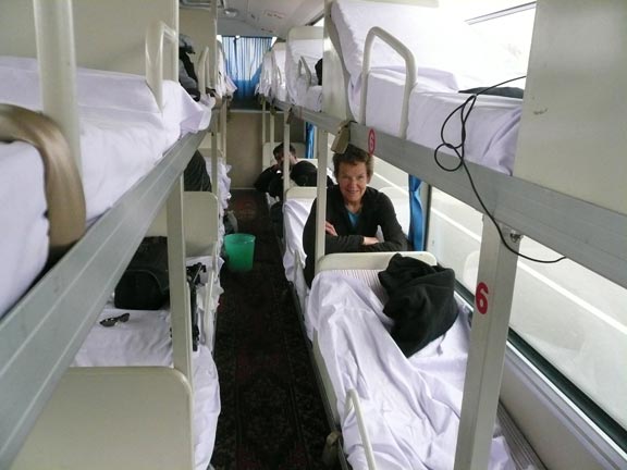
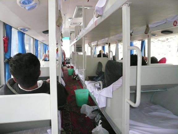
the KKH to all non-commercial traffic which forced us to take the public bus
which runs from Kashgar to Sost. We borded it in Tashkurgan (where it makes
an over-night stop after leaving Kashgar). We had to say good-bye to Akram
(below), whose company we enjoyed immensely. |
|
|
|
|
|
|
The Chinese bus was a riot, something we
have never seen before even though they are common in China. There are no
seats, only bunk beds with a raised portion for the head. For Westerners not
used to sitting in a cross-legged fashion they are quite uncomfortable. The
isles are so narrow, that two people cannot pass each other. In order for the busses to run, they
require 10 passengers. For days, it was uncertain if the bus would even leave
Kashgar. When we boarded, we were 12 passengers
total. At the border checkpoint the friendly but |
|
Inflexible Chinese border guards refused
two Germans to continue as they didn’t have a Pakistani visa (even though
regulations permit getting a visa at the Pakistani check point). They also
didn’t let an old Pakistani man continue because he had bought two cute
little dogs in China and didn’t have any health papers for them. When the bus
continued into Pakistan, we were only nine passengers. Even though uncomfortable, that bus ride
was a memorable experience. Below is
scenery photographed through the windows |
|
|
|
|
|
|
|
|
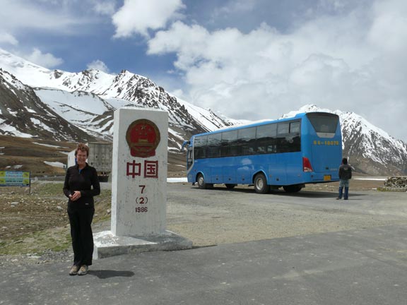
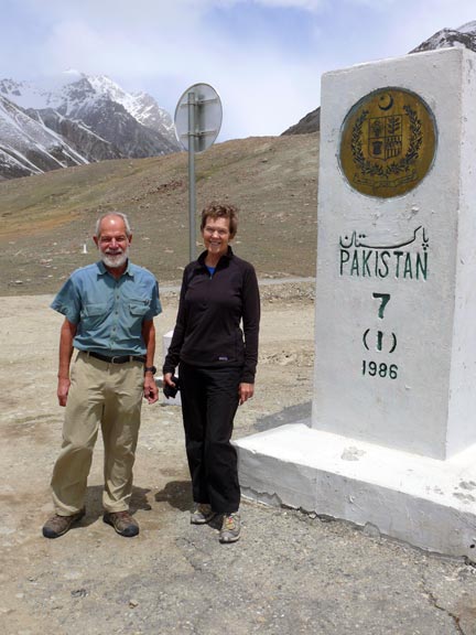
The bus let us out at the actual border
which is the top of the Khunjerab pass (15397 ft).
Below are the Chinese and the Pakistani border markers at the summit. |
|
|
|
|
|
|
|
|
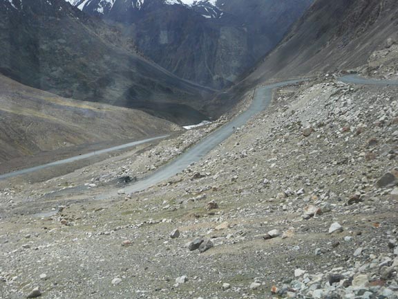
The moment one crosses into Pakistan, the
road narrows and is not always surfaced. The road condition on the Chinese side
is excellent. Also drivers have to switch to left-hand drive, a left-over
from the British. China is right-hand drive. |
|
|
|
|
|
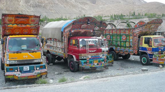
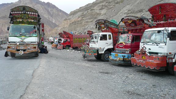
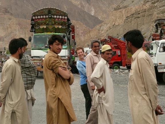
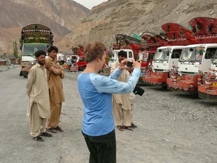
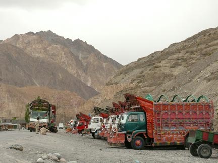
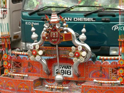
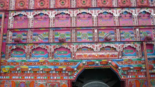
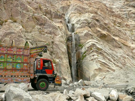
The Pakistani border station is in Sost, quite some distance into Pakistan. We found many of
the characteristically painted Pakistani trucks. Most of them are artworks in
themselves. We took so many pictures just of these unique trucks that we
grouped them together in special section. Click on KKH trucks to view them. Next to Yvonne in the picture on the
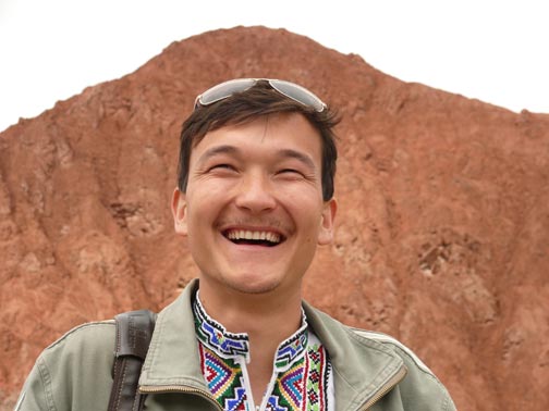
right is our new guide for Pakistan, Amir Khan - another outstanding guide (our
new driver Rashid is shown in later pictures). Amir Khan is a gentle man and
a devout Muslim. When we started in the car every morning, Amir Khan first
prayed for a safe journey. He concluded the prayer with and used this phrase
frequently throughout the day: Insha’Allah (God willing). |
|
|
|
|
|
|
|
|
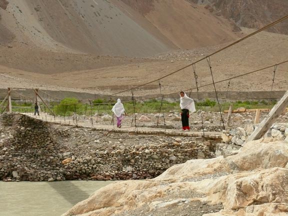
A typical Pakistani hanging bridge. The mountain scenery below is absolutely
stunning. |
|
|
|
|
|
|
|
|
|
On the left and below are the usual road
obstacles caused by slides and floods. |
|
|
|
|
|
|
|
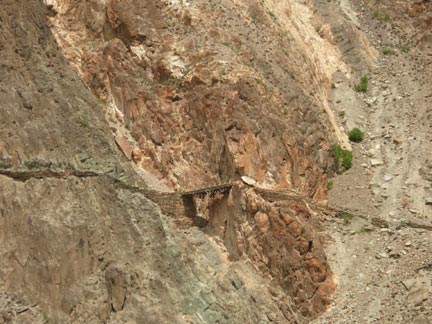
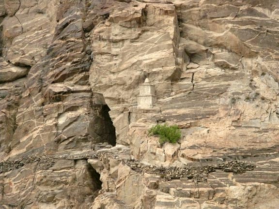
Above and below are
remains (and sometimes still used) parts of the historical Silk Road. It sometimes
seems incredible that these were actual roads. On the bottom right is a
monument in honor of Marco Polo who is said to have used the adjacent cave. |
|
|
|
|
|
|
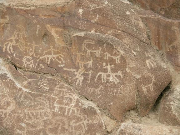
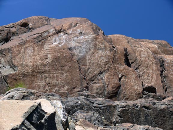
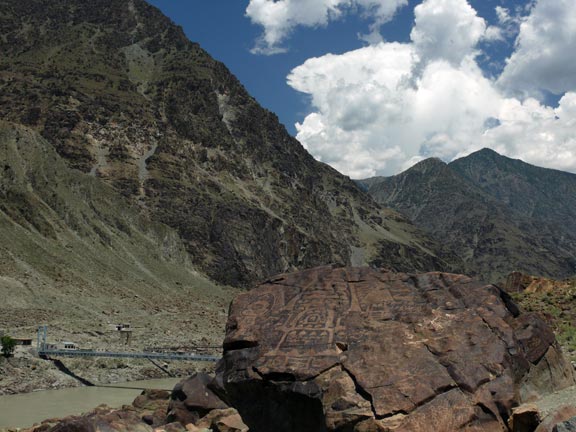
Just before getting into Karimabad (Hunza) we saw these
ancient petroglyphs. We stayed in Hunza for four nights and devoted a special section to
this wonderful region. |
|
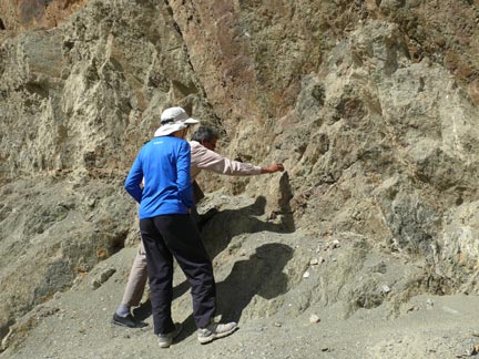
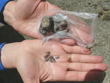
Continuing on the KKH after our stay in
the Hunza region, we had this magnificent view of
the Rakaposhi mountain (25,551 ft). The pictures below show Yvonne and Amir
Khan gathering garnets at the roadside. |
|
|
|
|
|
|
|
|
|
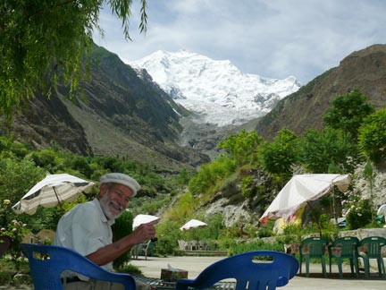
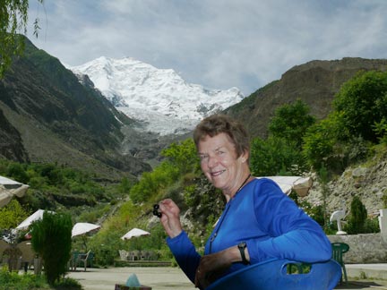
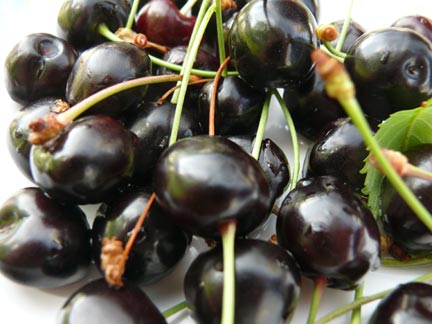
We paused at this little road side stop
and were offered most delicious dark red cherries. |
|
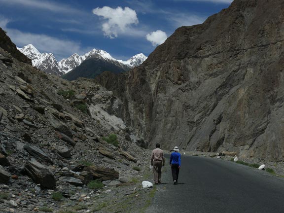
Whenever it was convenient, we walked a few
miles and the car followed us. Note the old Silk Road above on the right.
Amazing! |
|
|
|
We’re now in Gilgit
which is an entrance point into the Northwestern Territories of Pakistan.
Women are mostly absent and when present pretty covered up. Since we insist
to eat local (there isn’t much else in Gilgit) Amir
Khan took us to a little restaurant and we went upstairs where families are
served. Food is served in communal dishes and one has no utensils. One eats
by pinching the food between ripped off pieces of flat bread. It’s fun and
the food is very tasty. |
|
|
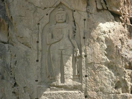
Outside of Gilgit
there is a large Buddha carving in the rocks. Its inaccessibility shielded it
from Islamic iconoclasts. The image dates from around 1400 CE. |
|
|
|
|
|
We walked quite a bit in Gilgit on the streets and in the bazaar. Except for the picture on the left our
guide didn’t let us photograph anything; the atmosphere was just too tense. If asked we didn’t admit to be Americans.
In such situations we’re either German or Canadian (without lying that much). |
|
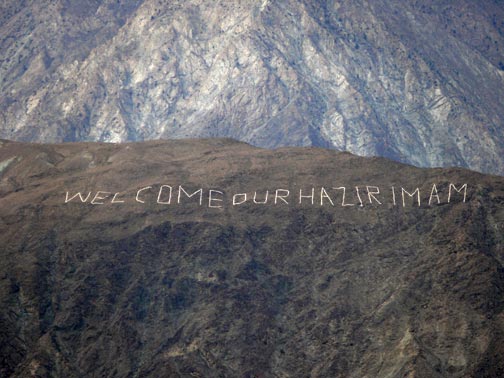
The area is quite a mixture of different
ethnic groups and religious traditions. The inscription on the right
addresses the leader of the Ismailis, Karim Agha Khan who lives in
London and doesn’t speak the local languages. Hazir
Imam refers to him. |
|
|
|
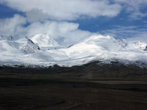
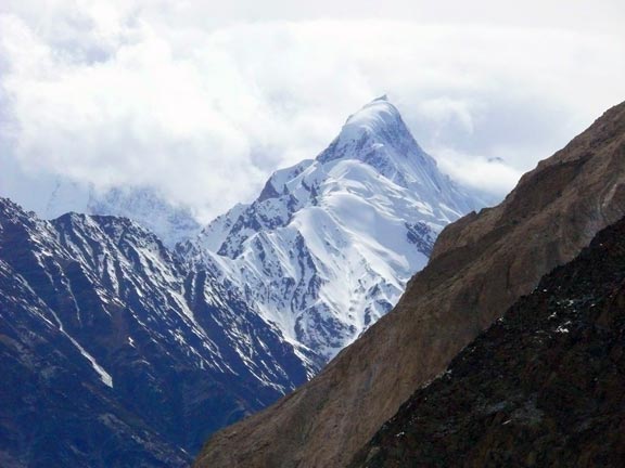
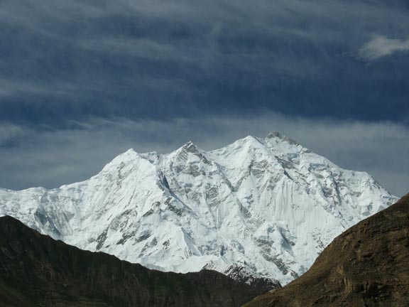
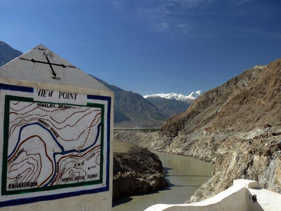
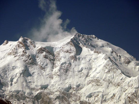
We’re now at the confluence of the Indus
and the Gilgit rivers (below left). The Himalayas
are in the north, the Karakorams in the west, and
the Hindukush in the south. In the photo is the
26,660 ft Nanga Parbat (picture on the left and below right) considered to be
the deadliest mountain in the world. In 1939, Heinrich Harrer
attempted to climb it. WWII interfered and he was interred in India. He
escaped to Tibet and spent seven years there interacting with the young Dalai
Lama (Harrer, Seven Years in Tibet). The background of this website is also
the Nanga Parbat. |
|
|
|
|
|
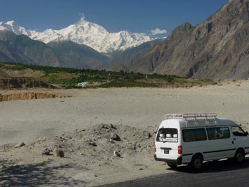
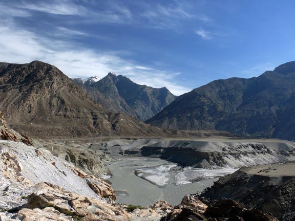
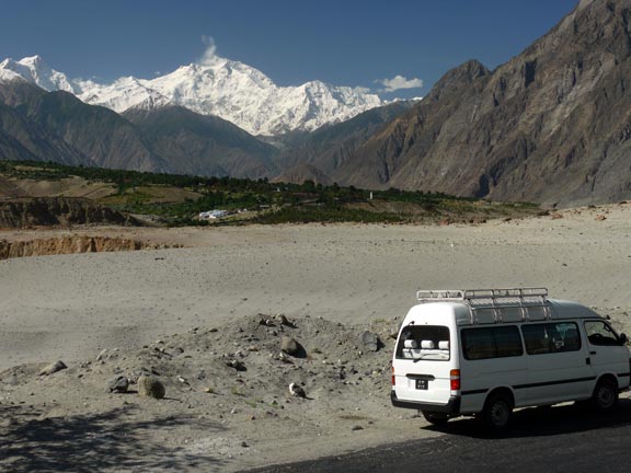
Another picture of Nanga Parbat with the
nice vehicle we had in Pakistan. Nanga Parbat was finally climbed in 1953 after
31 people had died before in failed attempts. Nanga Parbat is only 1-2
million years old (young?) and still grows some 1 cm per year. |
|
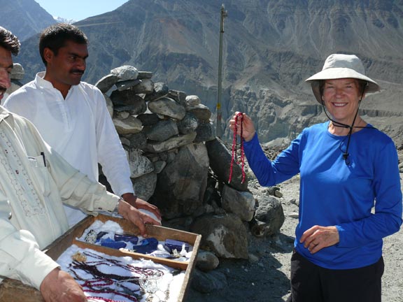
When we briefly stopped for pictures
jewelry salesmen appeared on bicycles out of nowhere. Yvonne holds two nice
ruby necklaces that followed her home. Rashid our driver is in the middle. |
|
|
|
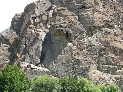
On the left are 4th – 7th
c. Buddhist rock carvings which aren’t too badly defaced. |
|
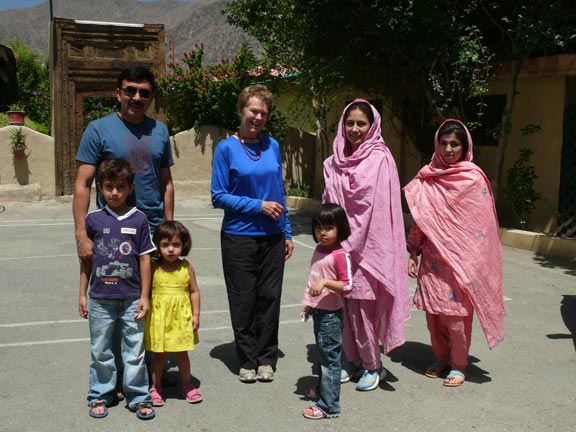
We met this family (husband, wife, nanny,
three children) who were quite friendly and interested in where we came from
and how we liked Pakistan. |
|
|
|
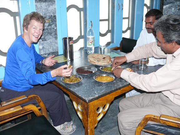
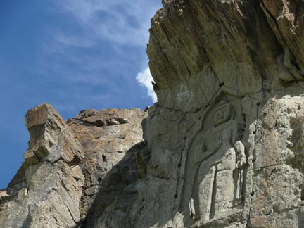
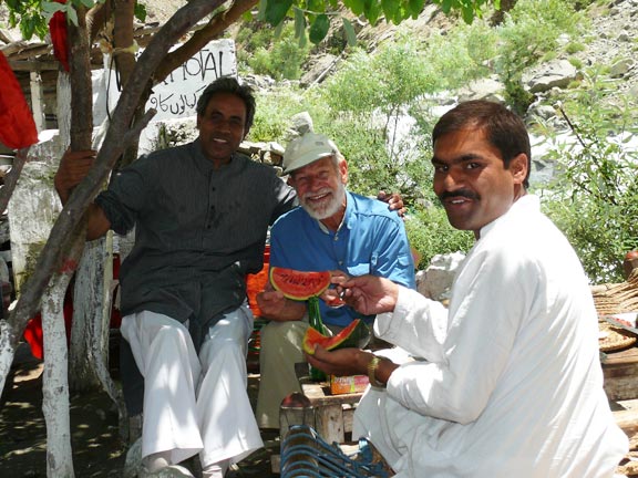
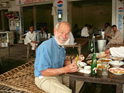
More Buddhist rock art also dating from 4th
– 7th c. CE. Below, we stopped for lunch at a small
road-side place and enjoyed the local food. Water was thundering down the
mountain just below where we were sitting. The fellow in white is our real nice
driver Rashid. |
|
|
|
|
|
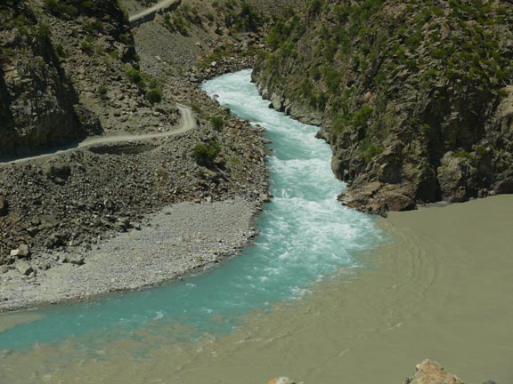
This is a picture of one of the many
tributaries of the Indus river that by now has pretty murky water. |
|
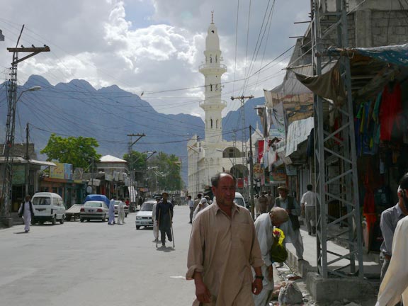
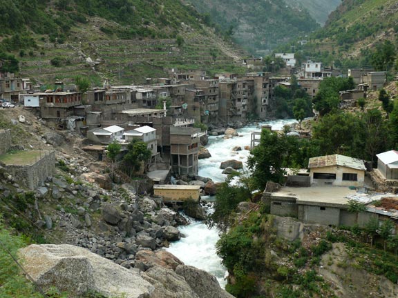
This is a part of Besham,
another city where we saw Taliban and tried to keep low profile. |
|
|
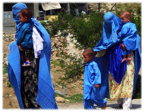
Women
are not often seen in public and when they are, they often wear burkas. The two Afghan (because of the characteristic
blue color) ladies on the right wear some pretty flashy clothes but are
completely covered. We
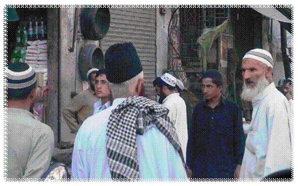
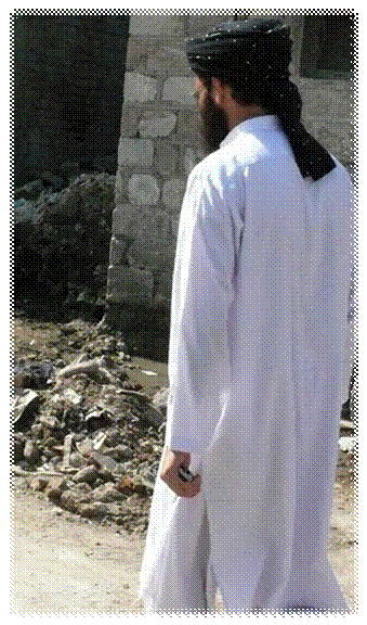
were told that the fellow with the fur hat below and the one below right were
Taliban. Note the cell phone in his left hand. We
took a lot of shots of locals mostly from the car. They are grouped together
in KKH people website. |
|
|
|
|
|
|
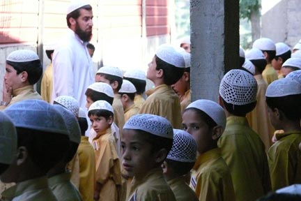
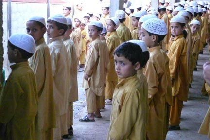
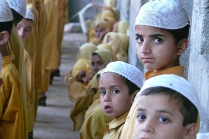
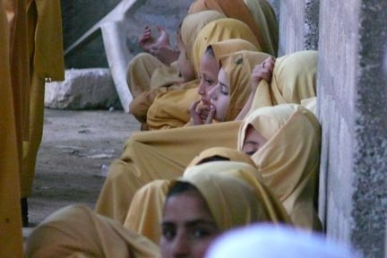
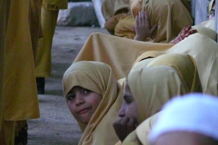
We stopped at an Islamic school and the
teacher permitted us to take pictures. We loved the curious faces of the boys
and the furtive looks of the girls in the back row. |
|
|
|
|
|
|
|
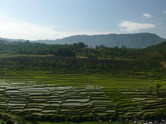
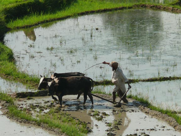
Cultivating
rice. Timeless images. |
|
|
|
|
|
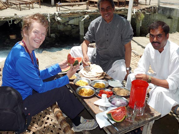
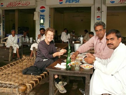
Another roadside lunch
stop. Note, Juergen got his hot green chili pepper. But only a 7up (no beer, we’re
in an Islamic Republic). |
|
|
|
|
|
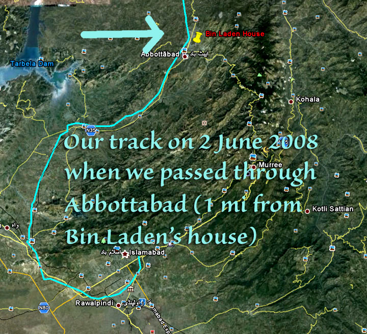
When
Osama Bin Laden was killed in 2011, the exact location of his house in Abbottabat was published by the media. We went back to
our GPS tracks of 2008 and found out we had passed his house within one mile when
travelling on the KKH to Islamabad. |
|
|
|