|
|
|
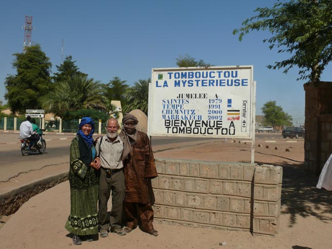
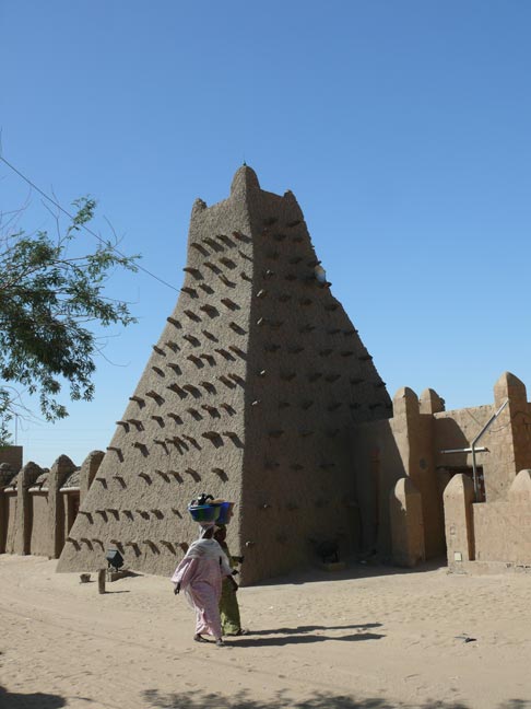
The three-day Niger river ride on a pinasse took us to
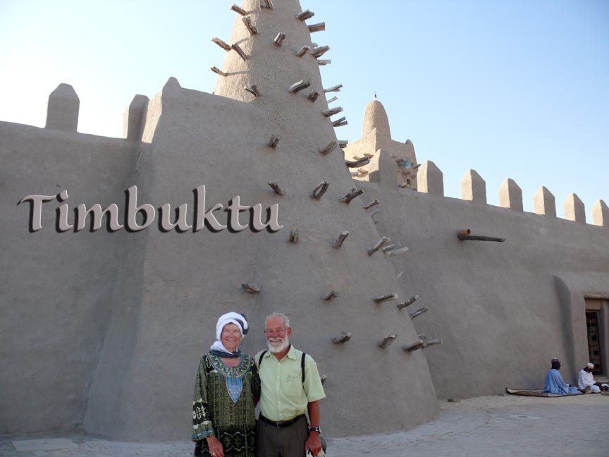
Timbuktu (actually Timbuktu is some 10 miles north of the Niger river). The
picture above shows us in front of the famous Djingareiber mosque built in 1325 (also a UNESCO
WHS). We spent two nights in Timbuktu and did a lot of sightseeing.
Most tourists fly to Timbuktu and don’t stay overnight. Our guide told us
that we and four other Tourists were the only over nighters on the first
night. A few more came the second night. We had some concern going to Timbuktu because of recent
kidnappings in the outlying areas of Mali. At the time of our visit, Timbuktu
was off limits for the French (French hostages were held and their fate was
unknown). We decided to include Timbuktu because of its rich history and
fame; and we’re glad we did so. Time
magazine of 30 April 2012 compiled a list of the most influential places in
history. Timbuktu made the list because “It was the link of one of the most
important trade routes in Africa as far back as the 11th c. and
the remnants are still there.”
In the fall of 2011, several tourists were kidnapped and one
German tourist was killed when he resisted. In May 2012, Islamic
fundamentalists blew up a tomb of a venerated sufi
saint because they considered it idolatry… They also declared strict Sharia
law. |
|
|
Timbuktu was founded in the 12th c. by Tuareg
nomads. For a while it was just an oasis for travelers crossing the desert. Toward the end of the 14th c. gold and salt trading
routes crossed this conveniently located place at the end of the desert and
close to the Niger river. In the 16th c. there were some 150
Islamic schools and students came from far away drawn by an academic
reputation second to none in the western Sahara. Today, there are still
extensive collections of old manuscripts maintained by the original families.
There are groups trying to get funding to protect these manuscripts. |
|
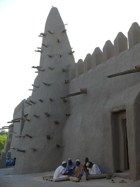
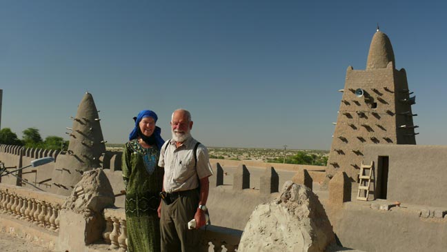
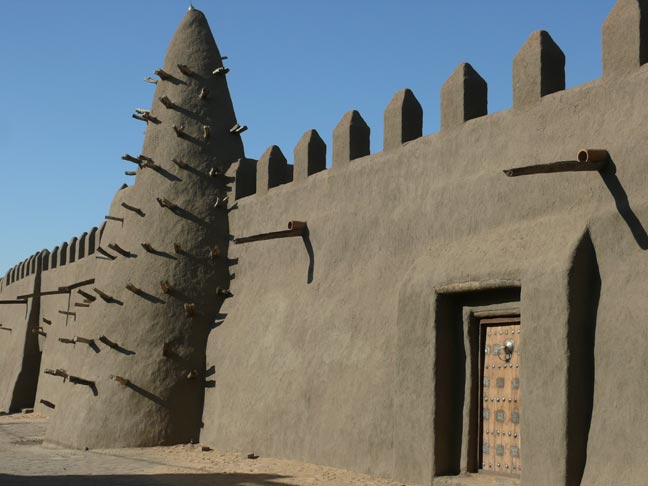
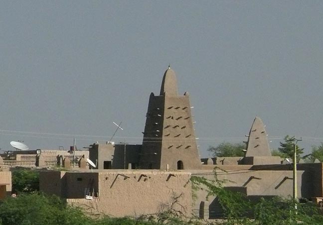
Above, right and below are pictures of the Djingareiber
mosque, one of three UNESCO World Heritage Site mosques in Timbuktu. Here we’re on the roof of a building across the street from
the mosque. |
|
|
|
|
|
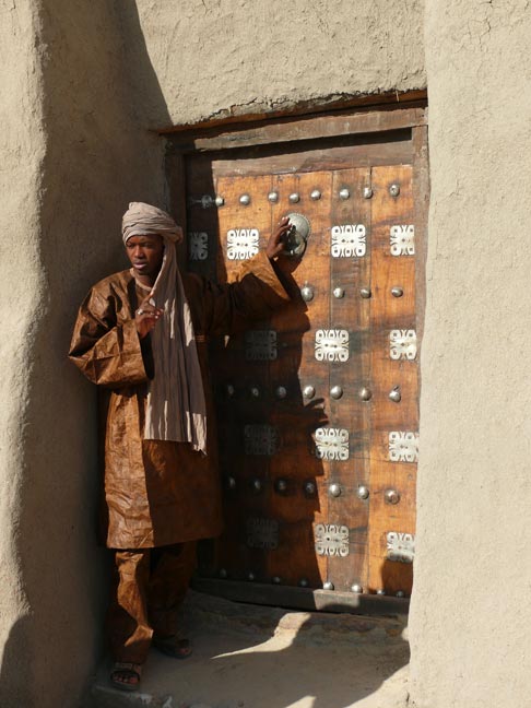
We had to take a local guide (in addition to Nianamou). He is
on Juergen’s left and also shown explaining the doors below. He was knowledgeable
and very nice. We asked him to put his scarf in the Tuareg way for this
photo. He was 19 and going to college, studying nursing. He said he
wanted to help educate the women Tuaregs toward better health. |
|
|
|
|
|
|
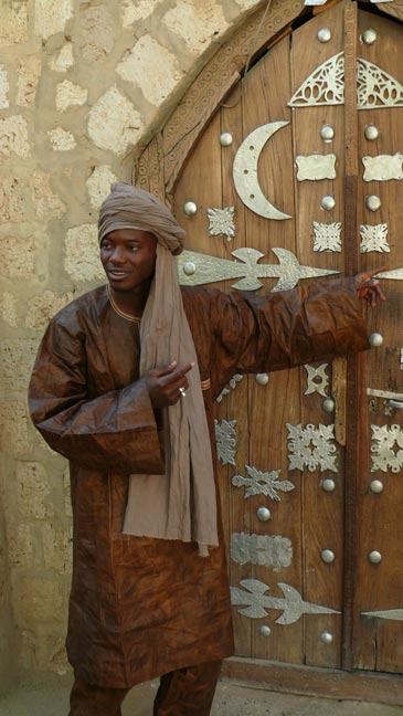
The interestingly decorated doors above and left belong to the
second WHS mosque named Sidi Yahia Mosque and madrassa dating from the 15th
c. |

|
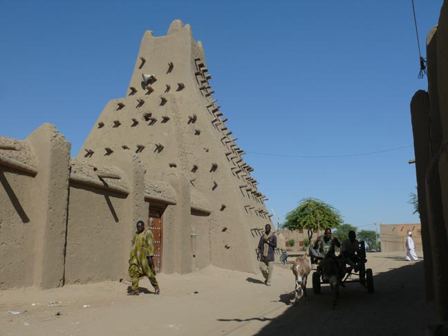
Right and below is the last of the three mosques, the Sankore
mosque built in the 14th c. Together, the three great mosques and madrassas formed an
important and influential Islamic learning center. |
|
|
|
|
|
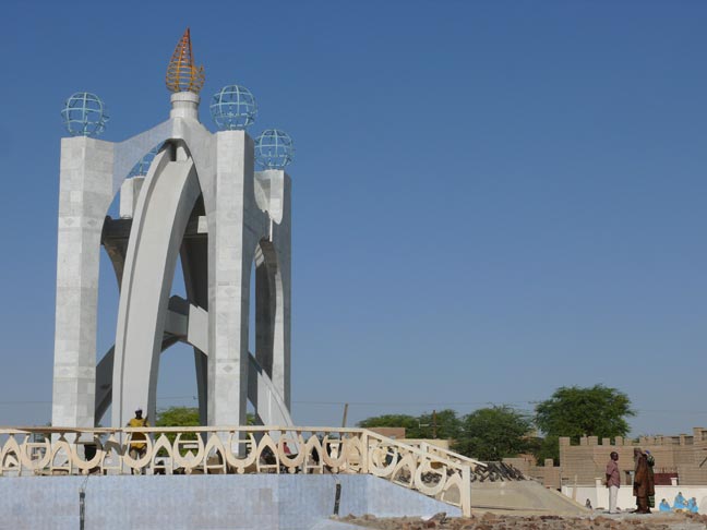
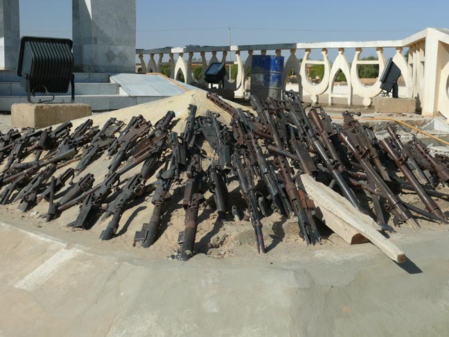
To commemorate the end of a 1996 Tuareg rebellion and a truce
between the Tuaregs and the Mali government , the monument on the right was
built with a hill of surrendered weapons (embedded in concrete) in front of
the monument (close-up below). Tuaregs really don’t like this memorial. |
|
|
|
At the time of this writing (spring 2012), another Tuareg rebellion
separated the Tuaregs from Mali. This rebellion also involved Islamic
fundamentalists, unwelcome in Timbuktu. So it goes. |
|
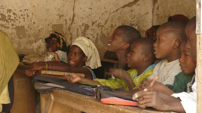
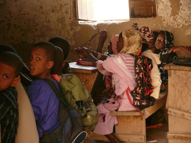
We stopped at a local school during class (right and below)
and watched those delightful children. Note boys and girls together. |
|
|
|
|
|
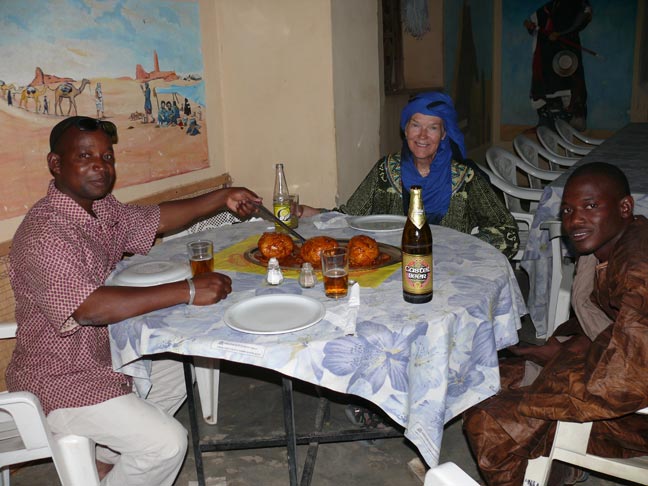
This lunch in Timbuktu was a delicious local specialty
consisting of huge dumplings. After the recent (2012) take-over by Tuaregs and Islamic
fundamentalists, the beer Juergen and Nianamou share wouldn’t be available
under the strict Sharia laws that govern this region now. That’s one reason
Juergen doesn’t want to convert to Islam. |
|
|
|
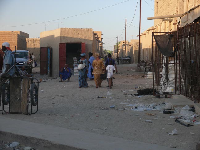
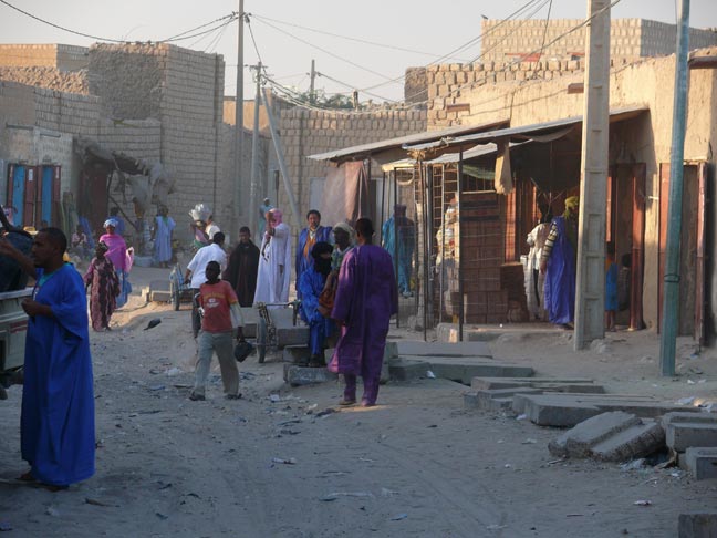
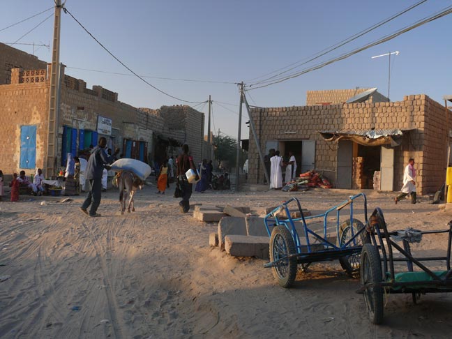
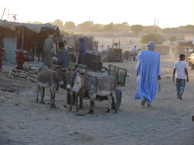
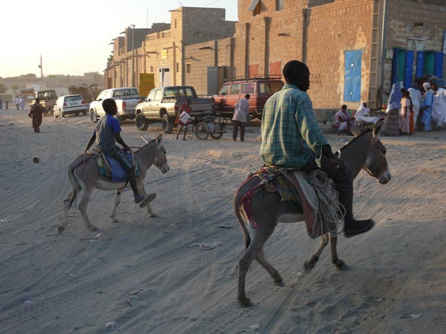
The following pictures are street scenes in “downtown” Timbuktu.
There are very few paved streets. |
|
|
|
|
|
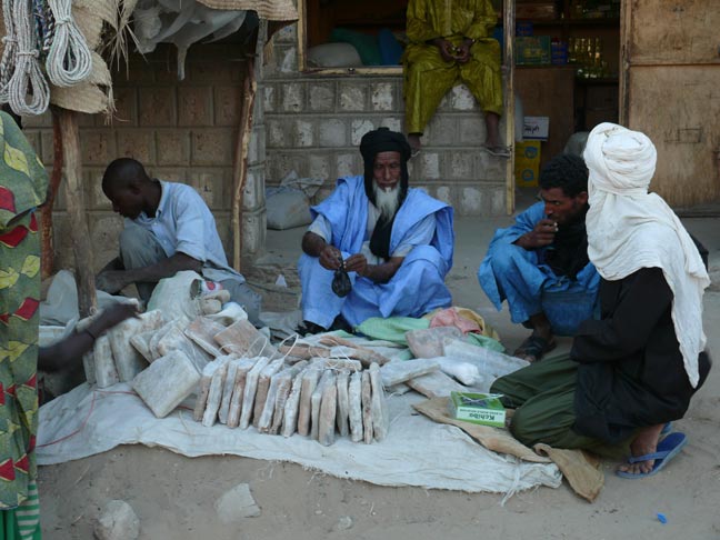
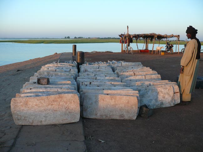
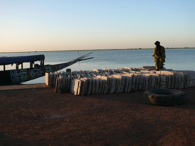
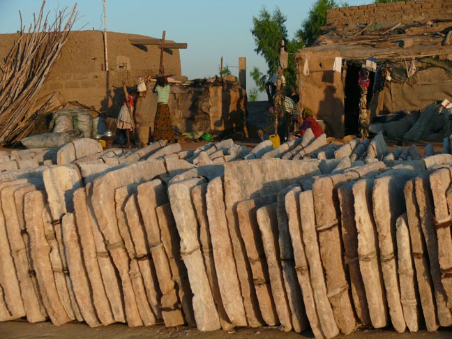
Salt slabs from the salt mines of Taoudenni in the north. |
|
|
|
|
|
|
|
Major street in Timbuktu. |
|
|
|
|

|
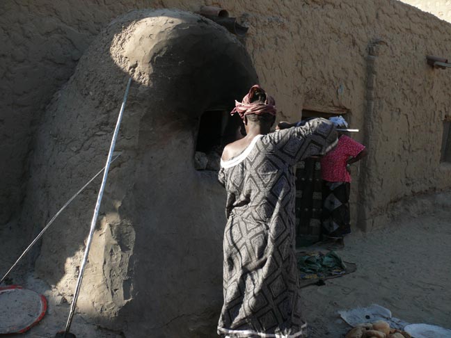
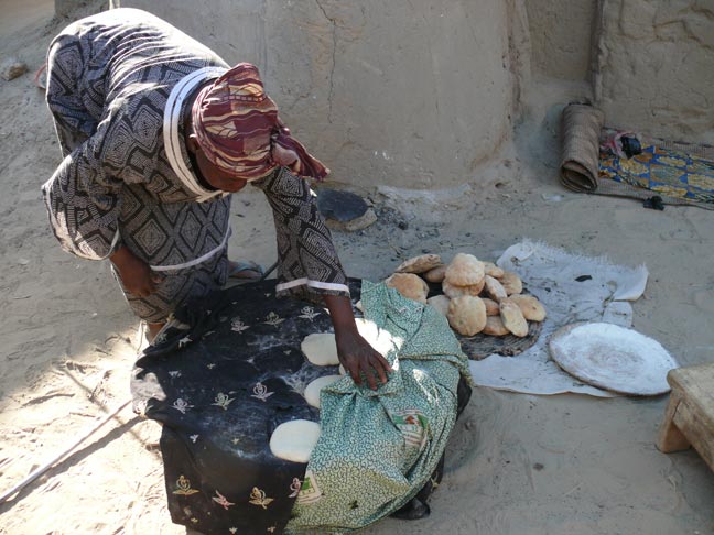
A lady baking bread in an oven. |
|
|
|
|
|
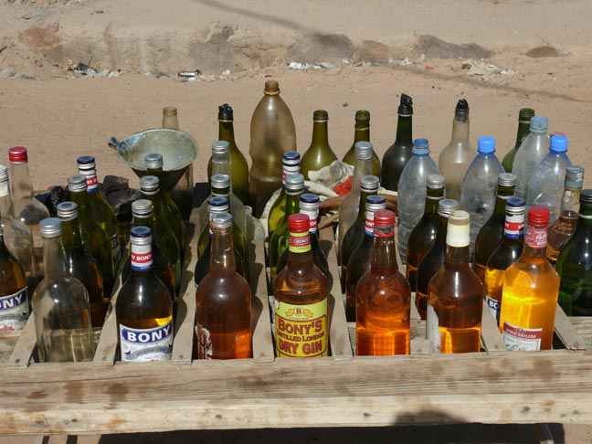
Nope, that ain’t booze. This is a gas station that sells gasoline stored in whatever
containers are available. |
|
|
|
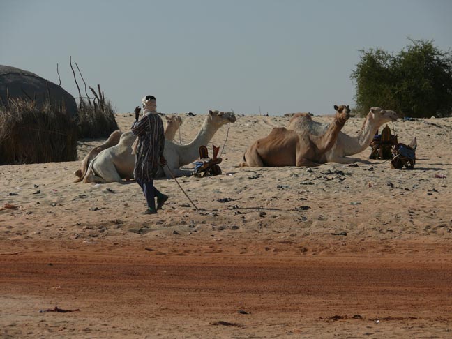
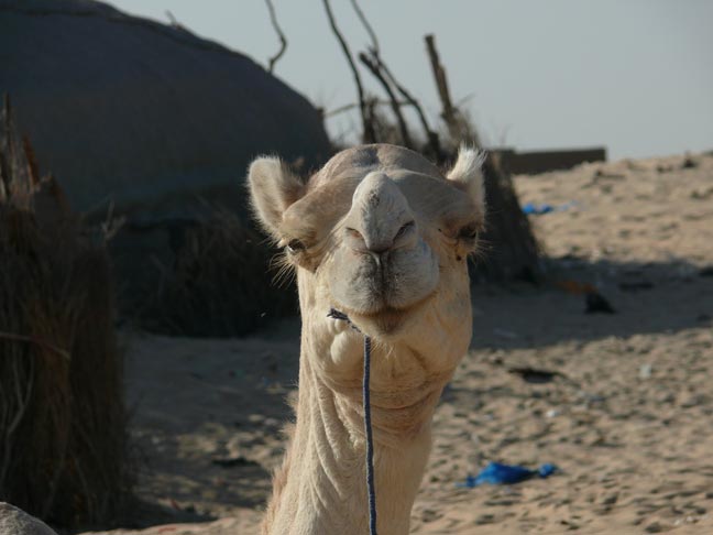
The great Sahara desert starts just outside of Timbuktu. A few
camels are available for tourist rides. |
|
|
|
|
|
|
|
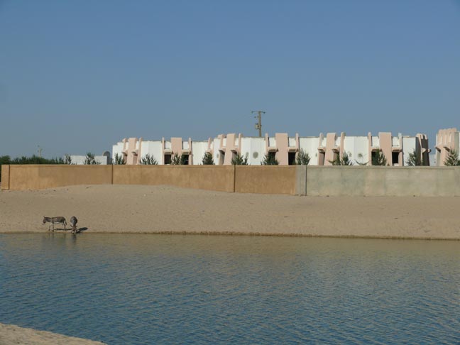
On the edge of town was this reservoir with a large, walled-in
resort complex that belonged to Gaddafi. It wasn’t open to the public yet,
but we were told that it was in the plans. Wonder what happened to it now
with Gaddafi gone and the Timbuktu under Tuareg control. |
|
|
|
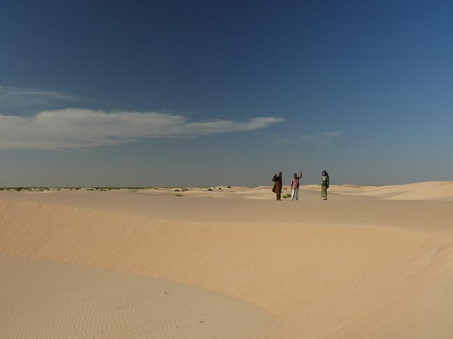
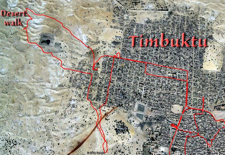
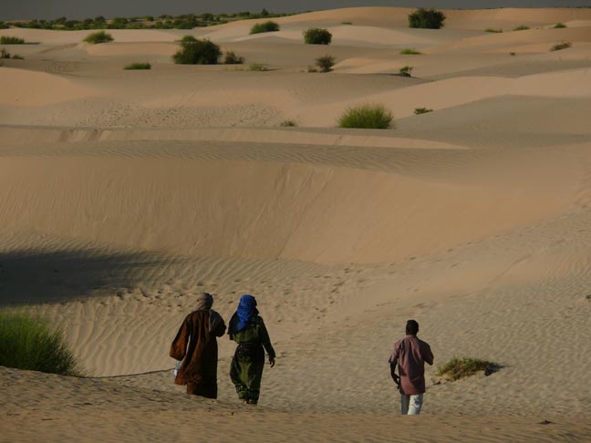
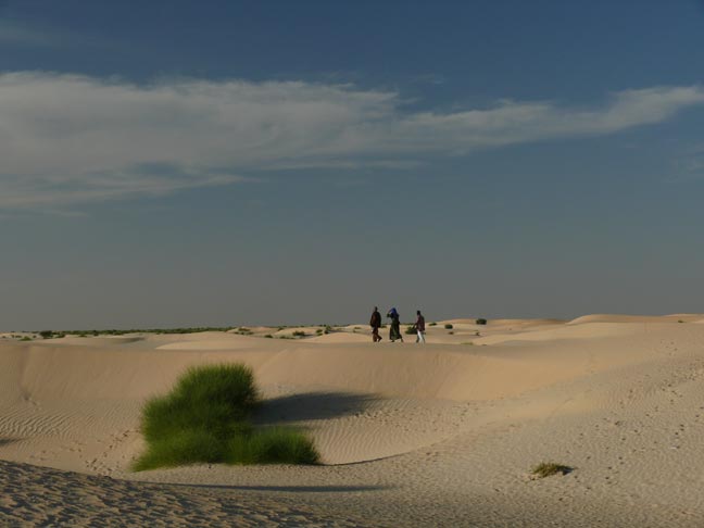
We took a long hike into the desert, it was absolutely
wonderful. The Google Earth picture below shows in red our walking tracks in
Timbuktu and the location of our desert walk. |
|
|
|
Our local guide is on the left, Yvonne in the middle, and
Nianamou on the right. |
|
|
|
|
|
|
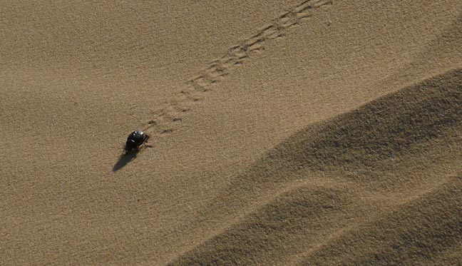
Watching this scarab beetle motoring along was fun. |
|
|
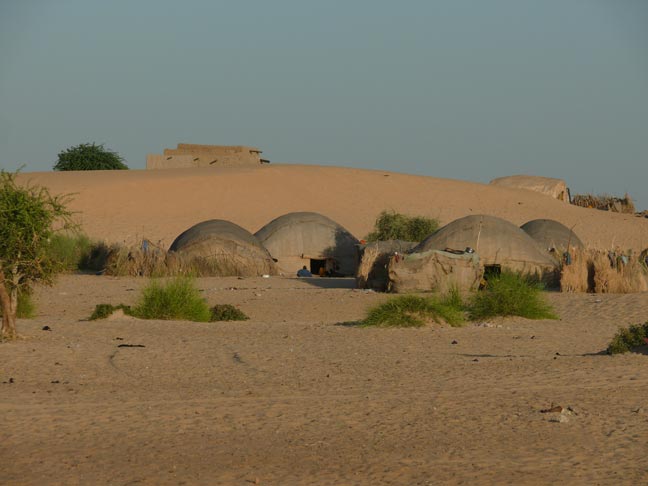
Tuareg tents. |
|
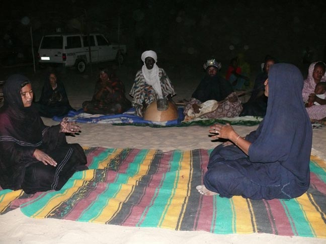
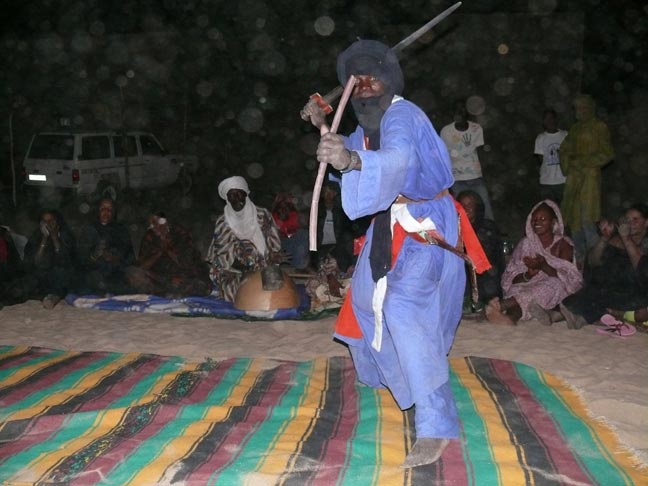
Belas put on a demonstration of the music on the right and… |
|
|
|
…fighting dances on the left. Belas used to be slaves of the Tuaregs, but that all was ended
by the Mali government long ago. They have a very similar culture to the
Tuaregs. They still live near one another. |
|
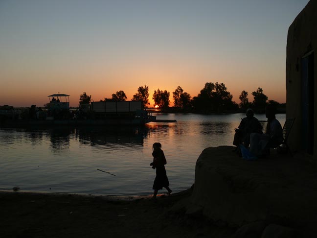
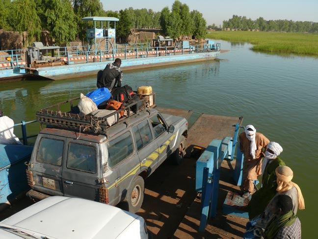
We left Timbuktu early in the morning to catch a ferry across
the Niger. On the other side of the Niger, a car picked us up and took us
back to Mopti. |
|
|
|
|
|
Above, right and below salt slabs which are still an important
commodity and which are being transported on the Niger to Mopti, Segou and
Bamako. |
|
|
|
|
|
|
|
|
|
We’re on the ferry waiting to cross the Niger. |
|
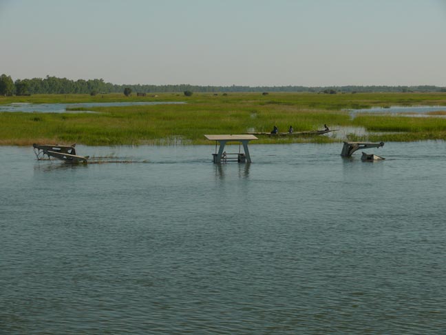
A sunken ferry… |
|
|
|
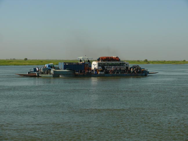
On the Niger after an incredible visit to Timbuktu. |
|
|
|